AA Holland Texel Wieringen Den Helder Zeekaart Hollandse Sea Chart kust Hoek van Holland Maas
€775
Title as mentioned on print
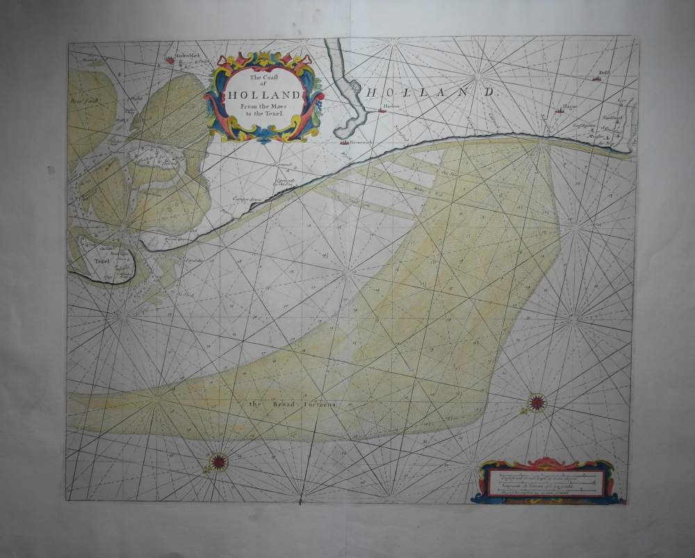
The Coast of Holland From the Maes to the Texel
Frame
Without frame
51.5 x 42.5 cm
Quality:
Technique
Original copper engraving manualy colored on paper
Description
Zeldzame zeekaart, met de doorgang tussen Texel en Den Helder richting Zuiderzee met Medemblik. rechts monding v d Maas. Titel Cartouche boven links, onder 2 kompasrozen en cartouche met de schaalstokken.
Material
Mooie zachte inkleuring, ruime marges, aan achterzijde op de middennaat versteviging aangebracht.
Maker
Drawer: John Seller (Hydrograaf), naar informatie van zeelieden, ontdekkers en kaartemakers
Engraver: Idem.
Publisher
John Seller (London, near the Tower of London)
Composer
Composer of this collection: J. Seller (c.a. 1630 - 1697)
Origin collection
The Coasting Pilot: Describing the Sea-coasts, Channels, Soundings, Sands,......etc.

 AA Wereldkaart Mappemonde Worldmap 058